Verify before you go. Details come from state agency records and may be out of date. Check local conditions, closures and fees with the managing agency before launching. Not for navigation.
Oyster Pile Public Boat Ramp
| Water body | Blackwater River |
|---|---|
| Water type | Salt or Brackish Water |
| County | Santa Rosa |
| City | Milton |
| Address / directions | 4566 Waters Street |
| Ramp type | Stand Alone Ramp |
| Lanes | 2 |
| Amenities | Restroom: Portable Toilet; Dock: Fixed Dock; No Accommodations for Accessibility |
| Fee | No |
| Parking | Not Paved - Gravel/Limestone/Packed Soil; trailer spaces 10 |
| Hours | 7am to 10 pm |
| Status | Open for Business |
| Owner / manager | Santa Rosa County |
| Agency notes | Status comments: There are two ramps at this facility. A double wide concrete ramp and a single wide sand and gravel ramp. Both have launch docks.
Concrete ramp has sever drop off at back Operational comments: There are two ramps at this facility. A double wide concrete ramp and a single wide sand and gravel ramp. Both have launch docks. Concrete ramp has sever drop off at back |
| Source ID | SR00021MH |
| Coordinates | 30.60209, -87.02905 · OpenStreetMap |
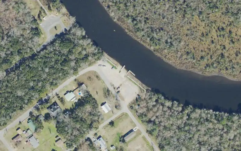
Map
Forecast
Loading forecast…
Source: National Weather Service (api.weather.gov), live.
Nearest water gauge
Yellow River Nr Milton, Fla. (USGS 02369600), about 6.7 mi away. It may be on a different water body.
Loading live readings…
Source: U.S. Geological Survey instantaneous values, live, provisional.
Report a change Also tell the agency: corrections to the source data help everyone.
Reviews
No reviews yet.
Nearest listed sites
- Bagdad Mill Site Park Kayak Launch — 0.1 mi
- Bagdad Public Boat Ramp (No Parking) — 0.4 mi
- Morrell Public Boat Ramp — 0.4 mi