Verify before you go. Details come from state agency records and may be out of date. Check local conditions, closures and fees with the managing agency before launching. Not for navigation.
San Sebastian River at Highway 16 Roadside Primitive Access
| Water body | San Sebastian River |
|---|---|
| Water type | Salt or Brackish Water |
| County | St. Johns |
| City | Saint Augustine |
| Ramp type | Hand Launch Only |
| Amenities | Restroom: Unknown; Dock: Unknown; Unknown |
| Fee | Unknown $None (Unknown) |
| Parking | Unknown |
| Hours | Unknown |
| Status | Open for Business |
| Owner / manager | Saint Johns County |
| Source ID | SJ00011AA |
| Coordinates | 29.91569, -81.32897 · OpenStreetMap |
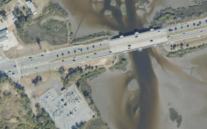
Map
Forecast
Loading forecast…
Source: National Weather Service (api.weather.gov), live.
Marinas and boat fuel nearby
- Inlet Marina (marina) — 1.8 mi
- Hidden Harbor Marina (marina) — 1.8 mi
- Saint Augustine Marina (marina) — 1.9 mi
- San Sebastian Marina (marina) — 2.0 mi
- Saint Augustine Municipal Marina (marina) — 2.0 mi
Source: © OpenStreetMap contributors (ODbL). Not verified; call ahead.
Report a change Also tell the agency: corrections to the source data help everyone.
Reviews
No reviews yet.
Nearest listed sites
- Vilano Causeway Primitive Access — 1.0 mi
- Fort Mose Historic State Park - Kayak Launch Dock — 1.0 mi
- Vilano Public Boat Ramp — 1.2 mi