Verify before you go. Details come from state agency records and may be out of date. Check local conditions, closures and fees with the managing agency before launching. Not for navigation.
Treasure Island 100th Avenue Public Boat Ramp
| Water body | Tampa Bay - Boca Ciega Bay |
|---|---|
| Water type | Salt or Brackish Water |
| County | Pinellas |
| City | Treasure Island |
| Address / directions | Gulf Blvd and 100th Avenue |
| Ramp type | Stand Alone Ramp |
| Lanes | 1 |
| Amenities | Dock: Unknown; No Accommodations for Accessibility |
| Fee | No |
| Parking | Not Paved - Gravel/Limestone/Packed Soil; trailer spaces 4 |
| Hours | Sunrise/Sunset |
| Status | Open for Business |
| Owner / manager | City of Treasure Island |
| Agency notes | Status comments: Ramp has parking for 4 trailers but no parking for vehicles Operational comments: Ramp has parking for 4 trailers but no parking for vehicles |
| Source ID | PI00229HD |
| Coordinates | 27.75922, -82.76524 · OpenStreetMap |
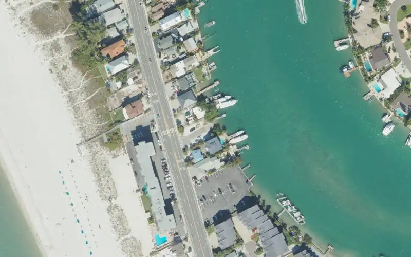
Map
Forecast
Loading forecast…
Source: National Weather Service (api.weather.gov), live.
Nearest water gauge
St Joe Creek At 62Nd St Nr Pinellas Park Fl (USGS 02308950), about 4.5 mi away. It may be on a different water body.
Loading live readings…
Source: U.S. Geological Survey instantaneous values, live, provisional.
Marinas and boat fuel nearby
- Hubbards Marina (marina) — 2.0 mi
- Madeira Beach Municipal Marina (marina) — 3.6 mi
- Lighthouse Point Marina (marina) — 3.7 mi
- Bay Pines Marina (marina) — 3.9 mi
- Gulfport Municipal Marina (marina) — 4.4 mi
Source: © OpenStreetMap contributors (ODbL). Not verified; call ahead.
Report a change Also tell the agency: corrections to the source data help everyone.
Reviews
No reviews yet.
Nearest listed sites
- Egan Park Ramp — 0.6 mi
- Treasure Island 84th Avenue Public Boat Ramp — 0.9 mi
- Treasure Island 123rd Avenue Public Boat Ramp — 1.6 mi