Verify before you go. Details come from state agency records and may be out of date. Check local conditions, closures and fees with the managing agency before launching. Not for navigation.
Westport
| Water body | Ohio River - Louisville |
|---|---|
| County | Oldham |
| Address / directions | Starting May 6th, 2019 and running for 100 days, there will be bridge work on West Highway 524 heading towards Westport. The 18-mile Creek Bridge will be closed during this time. Boaters wishing to use the Westport Boat Ramp are asked follow detour signage on Highway 42 and to take East Highway 524 (may show Covington Ridge Road on some maps) towards Westport. Boaters should stay on East Highway 524 all of the way to Westport, as there are no shortcuts off that highway. Boaters should watch for boat ramp directional signage when they reach the town of Westport. |
| Ramp type | Any Boat |
| Lanes | Multiple |
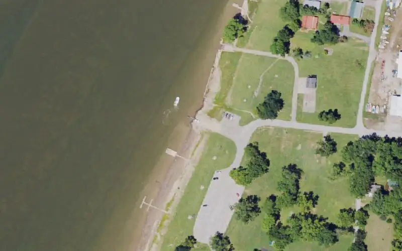
| Amenities | Courtesy dock; Restroom (year-round); Picnic area (year-round) |
| Fee | No |
| Parking | Paved parking; capacity 26 to 50 |
| Hours | 24 hours |
| Status | Open year-round |
| Agency notes | 18 Mile Creek Bridge will be closed for 3 months starting in May. Please see directions for alternate routes. Detour signs will be posted on the route. |
| Agency page | Kentucky Department of Fish and Wildlife Resources site page |
| Source ID | 477 |
| Coordinates | 38.47890, -85.48051 · OpenStreetMap |
Map
Forecast
Loading forecast…
Source: National Weather Service (api.weather.gov), live.
Nearest water gauge
Harrods Creek At Highway 329 Nr Goshen, Ky. (USGS 03292470), about 9.6 mi away. It may be on a different water body.
Loading live readings…
Source: U.S. Geological Survey instantaneous values, live, provisional.
Report a change Also tell the agency: corrections to the source data help everyone.
Reviews
No reviews yet.
Nearest listed sites
- Lake Jericho Recreation Area — 11.2 mi
- Long Run Park — 15.0 mi
- North Beckley Canoe Access — 17.2 mi